Master in Geoinformatics and Natural Resources Engineering
Current position: Remote Sensing Data Scientist, CORTEVA Agriscience, India
Research focus: satellite remote sensing and data science, agriculture, and environmental & soil science
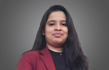
The second UN Sustainability Development Goal is “Zero hunger”. Parmita is remote sensing data scientist and agriculture engineer. She strongly believes that her research work can contribute to erase hunger by acting as a decision support system for all kinds of farmers and for decision makers likewise. She has adopted machine-learning solutions for satellite images for agricultural applications. During the development of all these applications she has closely worked with interdisciplinary groups like agronomists, statisticians, soil scientists, remote sensing experts, data science experts, commercial agriculture teams, and agricultural engineers.
So far, Parmita has developed applications for crop yield estimation, crop health monitoring, crop phenology mapping, crop classification, crop biomass estimation, and identification of water-saving rice varieties from satellite images. All these applications are crucial digital tools for agricultural monitoring and advisory generation.
The crop monitoring system she has developed can help farmers to get to know the problematic areas in their fields and take preventive and curative measurements to achieve the best possible yield from their piece of land. Agricultural experts can also use this system to advise farmers on farm inputs, irrigation, and the possibility of pest and insect infestation in the field.
Water supply is essential since water is one of the major driving factors for a lot of crop applications for monitoring and planning. The distribution of water by irrigation canals is challenging, and farmers at the tail end of the canal often faces water scarcity due to inefficient water use by farmers at the head end of the canal. Parmita’s application can help to precisely plan water distribution according to the water needs of the different crops.
Her yield estimation model can estimate the yield at a very early stage of crop development and with a minimum of information. This is crucial information for decision makers in the early stages of the growing season to prepare crop export and import strategies, subsidies to farmers, and minimum prices for crop support.
Water-saving rice varieties have a high cost-benefit ratio in terms of water productivity, labour cost and yield. Asian farmers are shifting from traditional rice varieties to water-saving ones. At CORTEVA Agriscience, Parmita is developing a rice variety detection algorithm that will be useful in advising farmers on how to ensure a smooth transition when introducing a new variety and for optimal yield.
The jury was impressed by this passionate scientist working interdisciplinary connecting her knowledge in remote sensing and agricultural engineering to help the world fight food scarcity.
Take a look at this video that briefly introduces Parmita and her research:


